
AI OVERVIEW3D scan building uses laser scanners to record a structure as millions of tiny data points. Surveyors turn those points into floor plans, elevations, and 3D models that match the real site. Owners, architects, and builders across NYC and Long Island use that data to plan renovations, catch clashes early, and skip expensive rework. |
TL;DR
|
Picture this. Your architect finishes the drawings. Your contractor orders the steel. Then someone checks the real wall, and it’s three inches off. That’s the exact moment 3D scan building was made to prevent.
Old buildings love to fib. Walls lean. Floors sag. And the plans in that dusty drawer? Often wrong. Guess badly, and you pay twice: once to build it, once to fix it.
Here’s the good news. You can know the truth before the first nail goes in. No guesswork. No crossed fingers. Let’s walk through how.
If you own, buy, sell, or build property in New York, this one’s for you.
What Is 3D Scan Building, Really?
A scanner sits on a tripod and spins. It fires laser pulses and times how fast each one bounces back. Every bounce becomes a dot in 3D space. Millions of dots together make a “point cloud.”
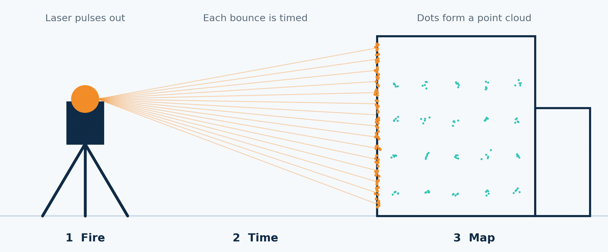
In plain terms, 3D scan building means capturing a structure’s true shape on site, then turning that shape into drawings and models you can use. Think of it as a photo you can walk through and measure. Top scanners log hundreds of thousands of points every second, so even a big structure goes quickly.
What Lands in Your Inbox
| Deliverable | What It Is | Who Loves It |
|---|---|---|
| Point cloud | Raw 3D dots of the site | Engineers, modelers |
| Plans and elevations | Clean 2D drawings pulled from the scan | Architects, permit teams |
| 3D model | Walls, beams, and pipes in full 3D | Designers, builders |
Tape vs. Laser: Who Wins?
No offense to the trusty tape. But it only records what a person thought to measure. A scanner records everything it can see.
| Factor | Tape and Sketch | 3D Scan |
|---|---|---|
| Field time | Long on big sites | Often hours |
| Detail captured | Only what you remembered | Everything in view |
| High or tight spots | Ladders and risk | Measured from the ground |
| Human slips | Easy to make | Far less likely |
| Return trips | Common | Rare |
Think of a tape as a flashlight and a scanner as stadium floodlights. One shows a patch. The other lights the whole room.
Same building. Very different odds.
Where 3D Scan Building Pays You Back
Not every job needs a scan. These ones do:
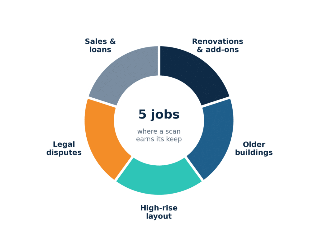
- Renovations and add-ons. Know how every wall, ceiling, and column really sits before you design around it.
- Older buildings. Drawings from decades back rarely match what stands today.
- High-rise and construction layout. Check each floor against the design as the project climbs.
- Legal disputes. A scan freezes a scene in time. That can matter in court.
- Sales and loans. Clear records calm buyers, lenders, and inspectors.
| PICTURE IT
Say you own a 1920s brownstone in Brooklyn. You want a new kitchen and a bigger opening between rooms. The old plans say the wall is straight. A scan says it leans. Now your designer knows before the cabinets are built, not after. |
Three Myths Holding Owners Back
| MYTH 1
“Scans are only for skyscrapers.” Nope. Homes, shops, and small offices gain too. A small job can hide a big surprise. |
MYTH 2
“My tape is good enough.” For a closet, maybe. For a full build, one missed inch can snowball into a pile of bills. |
MYTH 3
“It’s too techy for me.” You don’t run the scanner. You open the files, and your design team does the rest. |
Why Land Surveying GPS Belongs in the Same Plan
A scan shows the building. It can’t show where that building sits on your lot.
That’s where land surveying GPS steps in. It pins your model to real coordinates: property lines, setbacks, and ground heights.
Skip it, and you could design a lovely addition that crosses a boundary. Ouch.
GPS also checks ground levels. That matters for drainage, flood rules, and how high your new floor can sit.
Pair both, and everything lines up. One team. One set of numbers. No finger-pointing between trades.
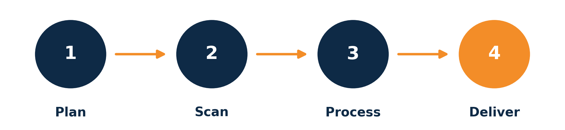
The Scan-to-Model Journey
| Step | What Happens | Your Part |
|---|---|---|
| 1. Plan | We study the site and pick scan spots | Share your goal and access details |
| 2. Scan | The crew captures the structure | Keep paths clear |
| 3. Process | Software stitches the scans into one cloud | Nothing. Relax. |
| 4. Deliver | You get models and drawings | Review, then build |
Five Perks Nobody Brags About
Most people book 3D scan building work for the measurements. They stay for the extras.
| 1 | Fewer site visits. The building lives on your screen, so your team can check it anytime. |
| 2 | Early clash alerts. Spot a beam fighting a duct before anyone orders parts. |
| 3 | Safer fieldwork. Less climbing, less leaning over edges. |
| 4 | A record for later. Next renovation? The data is already there. |
| 5 | Remote teamwork. Your architect in Midtown and your builder in Suffolk see the same thing. |
What Moves the Price?
Every property is different, so a 3D scan building quote never looks the same twice. These factors shape yours:
| Factor | Why It Matters |
|---|---|
| Building size | More space means more scan spots |
| Detail level | Fine detail takes more time to process |
| Site access | Tight or busy sites slow the crew |
| Deliverables | A full 3D model costs more than a plain point cloud |
| Timeline | Rush jobs need more hands |
What Skipping a Scan Can Cost You
Here’s the before-and-after nobody wants to live through.
| Skipped Step | The Ugly Result |
|---|---|
| Wall measured wrong | Materials arrive and don’t fit |
| Hidden beam and duct clash | Redesign mid-build |
| Old drawings trusted | Permit delays |
| No record of conditions | A weak case in a dispute |
Every one of these happens daily. Every one is avoidable. And while you sort it out, crews wait and the meter keeps running.
Five Questions to Ask Before You Hire
A scanner is just a tool. The brain behind it matters more. Before you pick a 3D scan building partner, ask:
|
If the answers come slowly, keep looking. A good surveyor answers fast and in plain English.
Final Word: Measure Once, Build Once
3D scan of your building won’t swing the hammer for you. What it does is hand you the truth before money moves.
You’ve seen the gap between guessing and knowing. Wrong walls. Hidden clashes. Late permits. Disputes with nothing to prove your side. Scans cut those risks down to size, and they do it fast. They also give your team one shared source of truth, so nobody argues over whose number is right.
Think about the last project that ran over budget. Odds are, a bad number sat at the root. Fix the number, and you fix the story.
The smartest owners don’t wait for a surprise to teach them. They scan first, then build with confidence.
Frequently Asked Questions (FAQs)
Q1 How much does a 3D scan building project cost?
It depends on size, detail, and deliverables. Most owners find it costs far less than one round of rework. Request a quote for a firm number.
Q2 How long does it take?
Fieldwork on many buildings takes hours to a couple of days. Modeling takes longer, based on detail. We set the timeline before we start.
Q3 Will it disrupt my tenants or crew?
Scanners make little noise and touch nothing. Our crew works around your schedule, so daily life keeps moving.
Q4 Is it accurate enough for permits and legal use?
In good conditions, scanners often land within a few millimeters. Licensed surveyors check the data and can pair it with land surveying GPS to tie it to your property. Confirm file needs with your permit team.
Q5 Do I still need a boundary survey?
Often, yes. A scan captures the structure. A boundary survey fixes your lot lines. Doing both blocks nasty surprises.
| YOUR NEXT MOVE
Don’t Let the Next Surprise Be Yours: Call Ferrantello Group Right now, someone near you is booking a scan. By the time their crew breaks ground, they’ll know every inch. Will you? Ferrantello Group has spent 50 years protecting property investments, from Montauk to Manhattan. We’ll plan your 3D scan building project, tie it to your lot, and hand you data you can lean on. Our crews know these streets, these codes, and these old buildings. That local grip saves you time. One call. One clear answer. Every week you wait is another week for hidden problems to grow into bills. Call (516) 249-6363 or request your quote today. Don’t guess. Know. CALL (516) 249-6363 | REQUEST YOUR QUOTE |