Land Surveying and Mapping
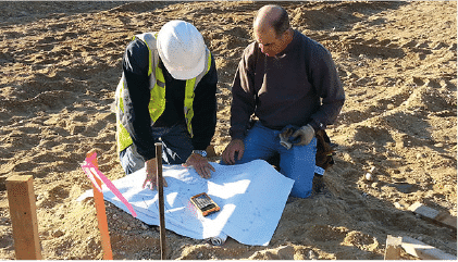
Getting a professional land survey is one of the best ways to protect your investment on your property and is necessary for any land-related project. Before buying, selling, adding onto, subdividing, or refinancing your property you will need a professional land survey. Before hiring a land surveyor, it is important to understand what a land survey involves. This way, you can make an informed decision and select a professional land surveyor of the highest quality.
Establishing your boundary lines and mapping the surrounding environment …
Our land surveying and mapping services are essential if you are looking to determine your property lines, open or closeout permits and/or obtain a certificate of occupancy, locate natural and manmade features, assist in the design of improvements or developments on a site and more. It is a land investigation, which defines location, dimensions, and area of a parcel of land, along with all rights the parcel enjoys or to which it is subject.
There are multiple phases included in this process including research, field reconnaissance, field survey, and drafting. Speak with our experts to see which one of our surveying and mapping services is right for you.
- Topographical Surveys
- Architectural Surveys
- Building Surveys
- Record or As-built Surveys
- Alta Surveys
- Title Surveys
- Monitoring Well Locations and Certifications
- Quantity Surveys
- Telecommunication-cell site and at FAA Surveys
- Utility and Vault Surveys
- Air and Development Right’s Surveys
- Subdivisions
- Route Surveys
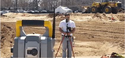
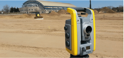
- GPS Surveying and Control Mapping
- Drone Mapping and Surveying

Topographical Surveys
Topographical Surveys utilize record benchmark or GPS survey methods to reference vertical datum to be used (NAVD 88), Field survey measurements and observations will be performed to compile, process and review collected research and field data. Survey analysis and calculations will be used to prepare mapping.
Architectural Surveys
Architectural Surveys begin with compiling research, including recorded deeds and maps. To reference vertical datum, record benchmark or GPS survey methods will be used (NAVD 88). Field survey measurements and observations will be compiled, processed, and reviewed. Mapping will be prepared utilizing the collected research and field data after performing survey analysis and calculations.

Building Surveys
Building Surveys begin with the gathering of research, field survey measurements and observations. The collected data will be compiled and reviewed to prepare mapping, which will include: Tax Lot Designations, the address of the property, bearings, distances, and area of property boundaries, locations and dimensions of buildings, locations and dimensions of accessory structures such as decks, swimming pools, sheds, and driveways.
Record or As-built Surveys
An As-built survey builds upon the base map of a project and includes research at local agencies, ground-level topography data, and the documentation of visible site improvements. The new map can be updated to show the current conditions of the site.

ALTA Survey
An ALTA Survey is a detailed survey performed by a registered licensed surveyor, such as the Ferrantello Group, prepared in accordance with the standards specified by the American Land Title Association (ALTA) and the American Congress of Surveying and Mapping (ACSM).
Title Survey
A Title Survey is a comprehensive investigation and evaluation of significant factors affecting and influencing boundary locations, ownership lines, rights of way and easements within or immediately surrounding a certain lot, parcel or quantity of real estate. A completed Title Survey map will include, but is not limited to: The bearings and distances of the subject property, discrepancies, if any, between property boundaries as described in record, information concerning adjacent properties as per record deeds, filed maps, and/or tax records, as well as observable physical evidence of possible easement conditions.


Monitoring Well Surveys:
Monitoring well survey maps provide the location of all the on-site monitoring wells in relation to existing features found on the property.
Quantity Surveys
Telecommunication-cell site and at FAA Surveys
Utility and Vault Surveys
Air and Development Rights Surveys

Subdivision Survey
A Subdivision Survey includes the review of all applicable zoning codes, as well as the maps/surveys provided by the client. Preliminary subdivision research and calculations will be performed to prepare a “Conceptual Subdivision Plan” of the proposed subdivision as directed by the client. Potential non-conformance issues with local zoning codes will be specifically noted. A “Topographic Survey” will be required to address possible problems/issues related to the existing topography of the subject property.